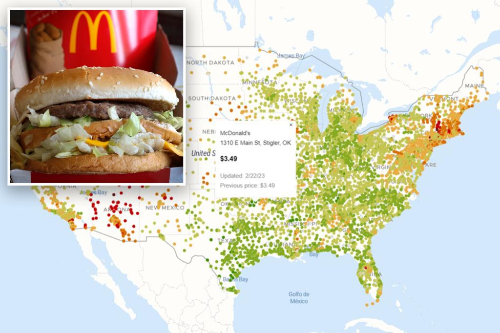
The McCheapest Map is a tool created by British analyst Sacha Fournier that tracks the price of a Big Mac at every McDonald’s location across the U.S. The map color-codes locations based on their prices, with green dots representing the best deals and red dots indicating the most expensive burgers. For example, the Lee, MA McDonald’s charges $8.09 for a Big Mac, while the cheapest option is in Stigler, OK, where the same burger goes for $3.49. Prices also vary across New York City, with some locations in the Bronx and Queens offering the cheapest Big Macs at $5.39, while the priciest option is $6.69 at the Westchester Ave. location in the Bronx.
While most people may not change their preferred McDonald’s location based on the prices shown on the McCheapest Map, it still provides an interesting way to see how their favorite spot compares to others around the country. Whether you’re a regular at the drive-thru or just looking for a fun way to save a few bucks on your fast food order, this tool can help you see where the best deals are. Additionally, there is another map called McBroken that tracks whether the ice cream machine at each McDonald’s location is working, providing even more helpful information for customers.
The McCheapest Map serves as a valuable resource for budget-conscious fast food lovers who want to make sure they’re getting the best deal on their McDonald’s order. By using this tool, customers can easily compare prices at different locations across the U.S. and make informed decisions about where to get their favorite items. From the cheapest Big Macs in Stigler, OK to the priciest options in New York City, the map offers a comprehensive look at the price discrepancies at McDonald’s locations nationwide.
As fast food prices continue to rise across the U.S., tools like the McCheapest Map become even more important for consumers looking to save money on their orders. By tracking the price of a Big Mac at every McDonald’s location, this map helps customers identify the best deals and avoid overpaying for their favorite menu items. Whether you’re planning a road trip and want to find the cheapest McDonald’s along your route or simply curious about how prices compare in different cities, this tool provides valuable information for anyone who loves fast food.
While the McCheapest Map may not lead to significant changes in where people choose to buy their McDonald’s meals, it does offer a fun and interesting way to see how prices vary across the country. Whether you’re surprised by the high cost of a Big Mac at a particular location or thrilled to find the cheapest option nearby, this map provides a unique perspective on the fast food chain’s pricing strategies. By highlighting the best deals and most expensive options, the tool gives customers a chance to make more informed choices about where to satisfy their McDonald’s cravings.
Overall, the McCheapest Map is a handy tool for McDonald’s fans who want to save money on their orders and explore how prices differ at various locations. Whether you’re a loyal customer interested in comparing prices at your favorite spots or a casual diner curious about the cost of a Big Mac across the country, this map offers valuable insights into pricing trends at the fast food giant. With features like color-coded markers and detailed location information, the map is a user-friendly resource for anyone looking to make smarter decisions about where to grab a meal from McDonald’s.


