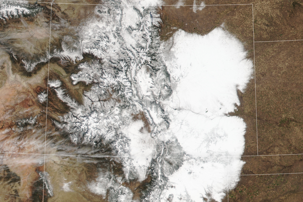
In early November, a powerful snowstorm struck Colorado and northeastern New Mexico, significantly boosting the region’s snowpack. Satellite images released by the NASA Earth Observatory captured the extent of the storm, which covered not only the high Rockies but also the Great Plains. The white expanse of snow was visible in eastern Colorado and New Mexico, with dense coatings covering mountainous regions to the west. While snowfall in the Rockies is not uncommon in November, the volume of snow on the Plains was particularly noteworthy this year, with some areas experiencing record-breaking totals.
Denver was hit hard by the storm, receiving 20 inches of snow, making it the 11th largest snowstorm on record for the city. The heavy snow disrupted daily life, with over 75,000 residents facing power outages in the Denver metro area. Parts of northeastern New Mexico were also affected, with snow totals reaching up to 40 inches in some areas. While major highways were briefly shut down, the storm created ideal conditions for ski areas, allowing some to open ahead of schedule. Breckenridge, a popular ski town, saw snowfall totals of up to 24 inches.
The snowpack accumulation from the early November storm serves as a critical water reserve for the region. Snow water equivalent measurements in several places were recorded at more than double the average for early November. This snowpack is crucial for areas experiencing drought conditions, such as Colorado, which entered November with nearly one-third of the state facing drought. Snow in the Rockies feeds water sources like the Colorado River, which serves millions of people across the U.S. and Mexico. While the storm’s impact on drought conditions is uncertain, the snowpack will supply essential water throughout the year.
It is essential to monitor the snowpack to assess its impact on drought conditions and water supply in the region. Eric Balken, executive director of the Glen Canyon Institute, emphasized the need to wait until January to gauge the snowpack’s effectiveness in addressing drought. Snowpack levels can change, affecting water availability in reservoirs like Lakes Mead and Powell, which are crucial for water supply in the region. The snowpack provides a vital resource for the area, ensuring water availability for various needs throughout the year.
Overall, the early November snowstorm in Colorado and northeastern New Mexico had a significant impact on the region’s snowpack and water availability. Satellite images captured the extent of the storm, which brought record-breaking snowfall to some areas. While the storm disrupted daily life and led to power outages, it also benefited the region’s ski areas. The snowpack accumulation from the storm serves as a critical water reserve, providing relief to areas experiencing drought conditions. Monitoring the snowpack and its impact on water sources like the Colorado River is essential for managing water supply in the region.


