


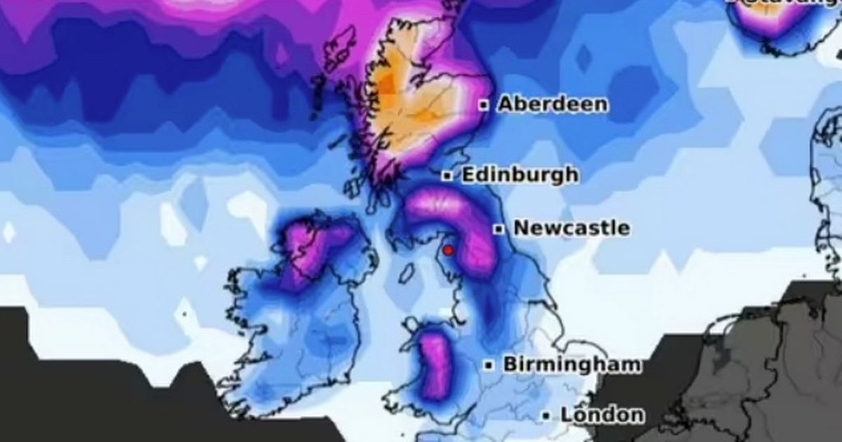
WXCharts are predicting that a 547-mile long wall of snow is set to hit the UK, with snow expected to fall from the top of Scotland down to the Midlands. The forecast shows that northern and central parts of Scotland have an 80 percent chance of seeing snow this weekend, with a 30 percent chance for the northwest of England. Parts of Wales and England could also see snow, with temperatures expected to drop below 0C with lows down to -5C for some areas. However, the Met Office suggests it is challenging to predict snowfall more than two days ahead.
The Met Office has a different outlook compared to WXCharts, forecasting heavy rain for the weekend with some sunshine expected early next week. They predict that the rain and showers will mainly affect western and northwestern parts of the UK, with potentially heavy and prolonged rain in upland areas. Strong winds are likely in the north, while drier spells with some sunshine are expected in southern and eastern areas, with near-average temperatures overall. The high winds from Storm Kathleen are expected to calm down, but rain and cloudy weather are expected to persist until after the weekend.
The detailed forecast for April 14 shows cloudy and rainy conditions in parts of Scotland clearing eastwards, while showers are expected elsewhere in the UK. The weather will be windy, especially along southern and western coasts, and it will feel cooler than the previous day. The night will bring clear skies for many areas, with showers easing, but cloud and rain will arrive in the far west by dawn. Wednesday will see dry weather for many regions, followed by rain and cloud spreading eastwards through the day, particularly heavy in northwest Scotland. The weather will be windy in the west and milder than Tuesday.
The forecast for April 15 onwards shows a continuation of changeable weather patterns, with a focus on rain and showers in western and northwestern parts of the UK. Rain could be heavy at times, especially in upland areas, while windy spells are expected, particularly in the north. Southern and eastern parts will see drier periods with some sunshine, and rain is likely to be less frequent and heavy than recent weeks. Overall, near-average temperatures are expected, but there may be cooler interludes, especially in the north. Showers are likely to persist in the north on Saturday, and warming temperatures are expected.
In light of the upcoming weather events, Dyson’s ‘game-changing’ hot and cool fan has been discounted by £100 in a Boots sale. Despite the mixed forecasts from different weather sources, residents in the UK should prepare for potential snowfall, heavy rain, and varying temperatures in the coming days. Monitoring updates from both WXCharts and the Met Office will help individuals stay informed about the changing weather conditions and plan accordingly to ensure their safety and comfort during this period of unpredictable weather.


