


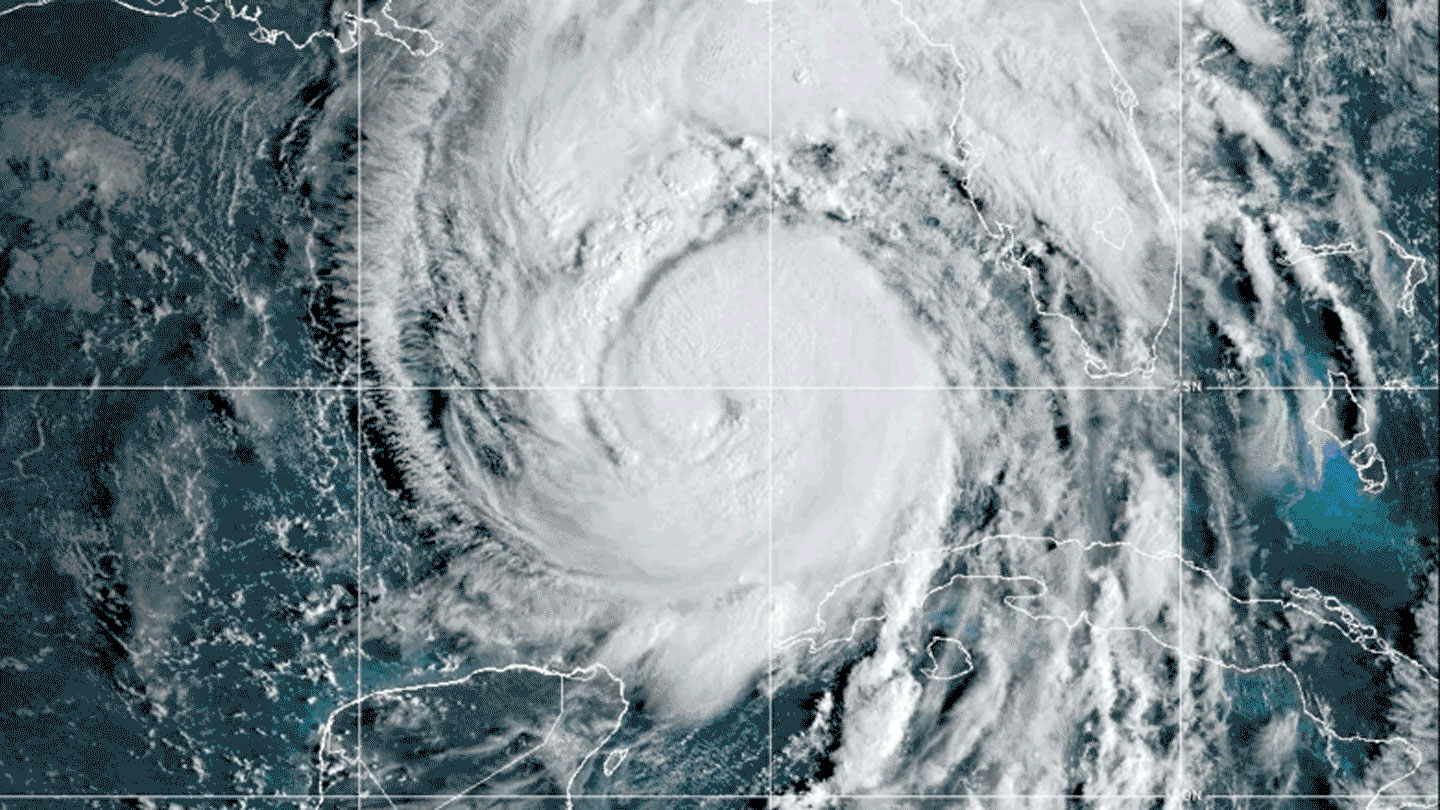
Helene, a powerful Category 4 hurricane that struck Florida’s Gulf Coast, intensified at a record-breaking pace, going from a tropical disturbance to a major hurricane in just 60 hours. This rapid intensification was fueled by warm ocean waters and the absence of wind shear, allowing the storm to grow quickly and unleash devastating winds and storm surges along Florida’s coast. Helene’s intensification is part of a trend of rapid intensification seen in recent hurricanes and is a result of the unusually warm waters in the Gulf of Mexico.
Scientists have been anticipating events like Helene’s intensification given the superhot waters in 2024. The Gulf of Mexico’s high sea-surface temperatures and deep warm waters provide abundant fuel for hurricanes like Helene to intensify rapidly. Additionally, the absence of wind shear in the Gulf allowed the storm to maintain its strength and continue growing. The combination of these factors made Helene a textbook case of rapid intensification and a cause for concern for scientists tracking the storm’s movements.
Smaller cyclones like Hurricane John, which intensified quickly and made an early landfall on Mexico’s Pacific coast, are also prone to rapid intensification. These storms, smaller in size compared to larger hurricanes like Helene, can catch forecasters and officials off guard with their sudden surge in power. Recent research has shown that smaller, compact storms may be more likely to intensify quickly and confound predictions, especially if the inner core of the storm is large at the outset.
In addition to coastal impacts, intensifying hurricanes like Helene pose risks far inland, leading the U.S. National Hurricane Center to introduce new forecasting maps that predict regions where powerful winds could be felt well beyond the storm’s path. This new type of projection aims to raise public awareness about hurricane hazards, even far from the storm’s eye or after landfall. Helene’s forecasted storm surges and large wind field were among the biggest in the center’s history, leading to widespread impacts across the southeastern United States as the storm continued its path northward.
Helene’s intensification and impacts highlight the need for improved hurricane forecasts that consider rapid intensification, storm size, and inland hazards. As climate change continues to warm ocean waters and create more favorable conditions for hurricanes, understanding and predicting the behavior of storms like Helene becomes increasingly important for safeguarding communities and minimizing the risks associated with these powerful natural phenomena. By studying the processes that drive rapid intensification and improving forecasting techniques, scientists and officials can better prepare for future hurricanes and mitigate the potential impacts on vulnerable coastal and inland regions.


