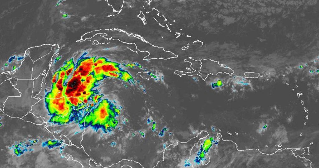
Tropical Storm Sara, the 18th named storm of the 2024 Atlantic Hurricane Season, formed in the western Caribbean earlier this week with sustained winds of 40 mph. It is currently located around 50 miles northeast of the Nicaragua-Honduras border and is moving westward. The storm is predicted to linger in the Caribbean through the weekend before slowly moving into the Gulf of Mexico early next week. Forecasters are uncertain about the exact path of the storm, with some models suggesting it could dissipate over Mexico or aim towards Florida.
The Atlantic Hurricane Season officially runs from June 1 to Nov. 30, with activity typically peaking between mid-August and mid-October. The National Oceanic and Atmospheric Administration predicted an “above average” season for 2024, with the potential for 14 named storms, seven hurricanes, and three major hurricanes. Tropical Storm Sara is expected to bring catastrophic rainfall to parts of Central America, with heavy rainfall of 10 to 20 inches possible in Honduras and up to 30 inches in some areas. Forecasters have warned of “life-threatening” flash floods and mudslides in northern Honduras and other regions.
As Tropical Storm Sara moves towards Central America, governments across the region have issued watches and warnings to prepare for its impacts. Vast sections of Nicaragua and Honduras are under either a hurricane watch or tropical storm warning. Forecasters predict that the storm may reach or be near hurricane strength as it approaches the eastern coast of Honduras. Residents of Belize and Mexico’s Yucatan Peninsula are also advised to prepare for possible impacts from the storm early next week. Hurricane hunters are flying into the area to investigate the strength and structure of the system.
It is uncertain whether Tropical Storm Sara will become a hurricane by the time it reaches Honduras, but forecasters expect it to be near or at hurricane strength. Some forecast models suggest that the storm could head towards Florida by late next week, while others predict it may dissipate in the central part of the Gulf of Mexico. The hurricane center cautioned residents in Florida, the Florida Keys, and Cuba to regularly monitor updates to the forecast. The storm’s path will depend on various environmental factors and historical data used by forecast models to produce “spaghetti plots” of potential tracks.
Overall, Tropical Storm Sara’s projected path remains uncertain, with forecasters closely monitoring its development. Residents in Central America, particularly Honduras, are advised to prepare for heavy rainfall and potential flooding. The storm’s impact on Florida and the eastern Gulf of Mexico will depend on how it develops over the coming days. Meteorologists are continuing to analyze data to provide timely updates on the storm’s strength and potential impacts.


