


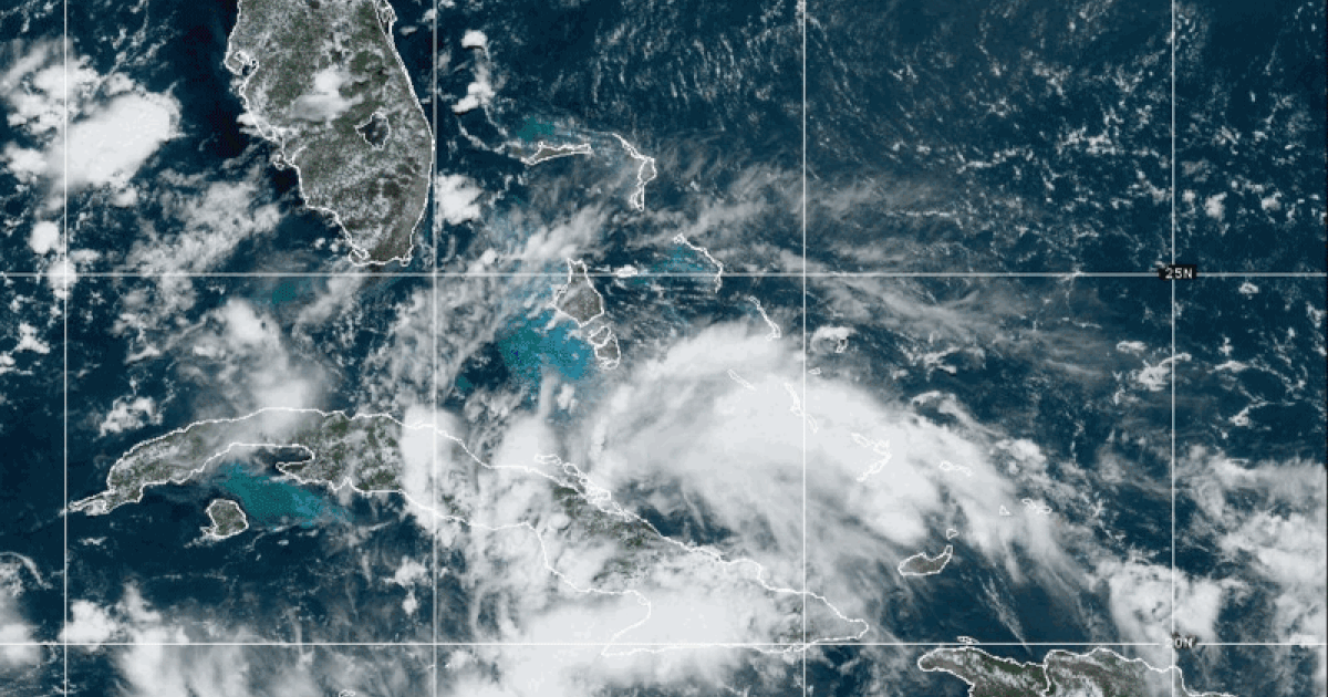
A storm south of Cuba is gaining strength and expected to become a tropical storm by late Saturday as it heads towards Florida’s west coast and the Gulf of Mexico. Referred to as Tropical Depression Four, the storm could potentially be named Debby once it reaches tropical storm status. With maximum sustained winds of 30 mph, just under the threshold of 39 mph for tropical storm status, the storm was located 75 miles south of Caibarien, Cuba, as of late Friday. The storm is forecasted to continue strengthening as it moves through warm Caribbean waters and is expected to become a tropical storm over the southeastern Gulf of Mexico by late Saturday.
A tropical storm warning has been issued for the west coast of Florida, from its southern tip to Boca Grande, indicating that winds of 39 to 73 mph are expected in the next day or so, along with potential storm surge, coastal flooding, and heavy rain in the affected areas. Additionally, a storm surge watch has been issued for much of the same area, including Tampa Bay, warning of the possibility of life-threatening flooding as coastal waters and other waterways overflow and surge onto dry land. A tropical storm watch is also in effect for some areas, including the Florida Keys south of the Card Sound Bridge.
The storm is projected to move northward into the Gulf of Mexico and linger off the west coast of Florida until early Sunday, bringing with it 1 to 4 feet of storm surge flooding, 4 to 8 inches of rain, and possibly up to 12 inches of rain in certain areas along its path. In Cuba, rainfall amounts of 1 to 2 inches are expected, with the possibility of higher amounts in some areas. The National Hurricane Center warns that the depression will likely continue to strengthen over the eastern Gulf of Mexico throughout the weekend.
This potential tropical storm, which could become the fourth named storm of the North Atlantic hurricane season, is developing slightly ahead of schedule, with the average date for the fourth named storm historically falling around August 15th. The storm could bring hazardous conditions and impacts to the affected regions, including strong winds, storm surge, flooding, and heavy rainfall. Meteorologists Michelle Acevedo and Steve Strouss are closely monitoring the storm’s progression and impacts as it continues to evolve in the coming days.
Overall, residents in the warned areas are advised to stay informed and prepared for the potential impacts of this developing tropical storm, such as strong winds, storm surge, flooding, and heavy rainfall. It is essential to heed the warnings and advisories issued by the National Hurricane Center, local authorities, and emergency management agencies, and to follow safety guidelines and evacuation orders if necessary. With the storm expected to strengthen as it moves through the Gulf of Mexico, it is crucial for residents to have a plan in place and to take necessary precautions to ensure their safety and well-being during this developing weather event.


