


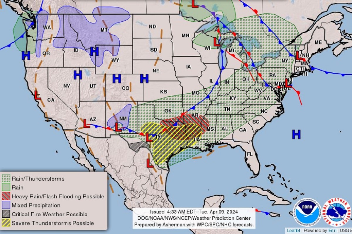
Texas is currently facing a range of severe weather warnings due to a low-pressure system bringing thunderstorms, tornadoes, and flash flooding. The northeastern part of the state has received flood warnings, advisories, and watches, with hazardous weather alerts. The southwest is under red-flag warnings for wildfires, while the far south has a fire-weather watch in effect. In March, the Texas Panhandle experienced large wildfires, with one becoming the largest in the state’s history and the second-largest in the U.S., prompting evacuations, a disaster declaration, and a statewide firefighting effort.
The National Weather Service forecasted that the weather front crossing the south would bring heavy rain and severe thunderstorms to eastern Texas before moving into Arkansas and Louisiana. The situation is expected to expand into the Texas Panhandle later in the week, with strong thunderstorms forecasted to move towards Florida. There are flood warnings in place for various rivers, with the NWS warning of large hail, damaging winds, and possible tornadoes in several regions. Tornado season typically runs from March to June in Texas, a state at high risk of tornado damage and one of the most expensive states for home insurance due to tornado risk.
Homeowners in Texas are facing potential damage to roofs, windows, and doors from the severe weather. Some residents may need separate windstorm insurance policies to cover tornado damages if not specified in their existing policies. In the Texas Panhandle, strong winds of up to 60 miles per hour and golf ball-sized hail are expected, along with persistent thunderstorms that could lead to flooding. The recent weather system is reminiscent of a similar threat faced by northeast Texas in February, when thunderstorms and large hail occurred due to another low-pressure system, an early sign of intense cyclogenic weather.
The low-pressure system’s strong winds pose an increased risk of wildfires spreading rapidly in Texas. Red-flag warnings are in place for the Big Bend region south of the Highway 90 corridor, where low humidity and erratic winds create critical fire-weather conditions. The southernmost part of the state also faces similar conditions, with winds gusting up to 45 miles per hour, potentially increasing the fire danger by Wednesday afternoon. Texas residents are urged to stay informed and take precautions to protect themselves and their properties from the various weather threats posed by the current weather patterns.


