


Baleares will experience the last effects of a weather system known as a “dana” (isolated high-level depression) on the Friday of the August long weekend. This weather system is weakening and moving towards the central Mediterranean, while an anticyclone will dominate much of the Iberian Peninsula. The State Meteorological Agency (Aemet) predicts that there is still a possibility of strong or very strong showers and storms in much of the archipelago, with a tendency for these to decrease in intensity from the afternoon onwards and affect more eastern areas. By Saturday, the dana, now weakened, is expected to be located around Italy, bringing an end to the heavy rainfall episode that began on Tuesday.
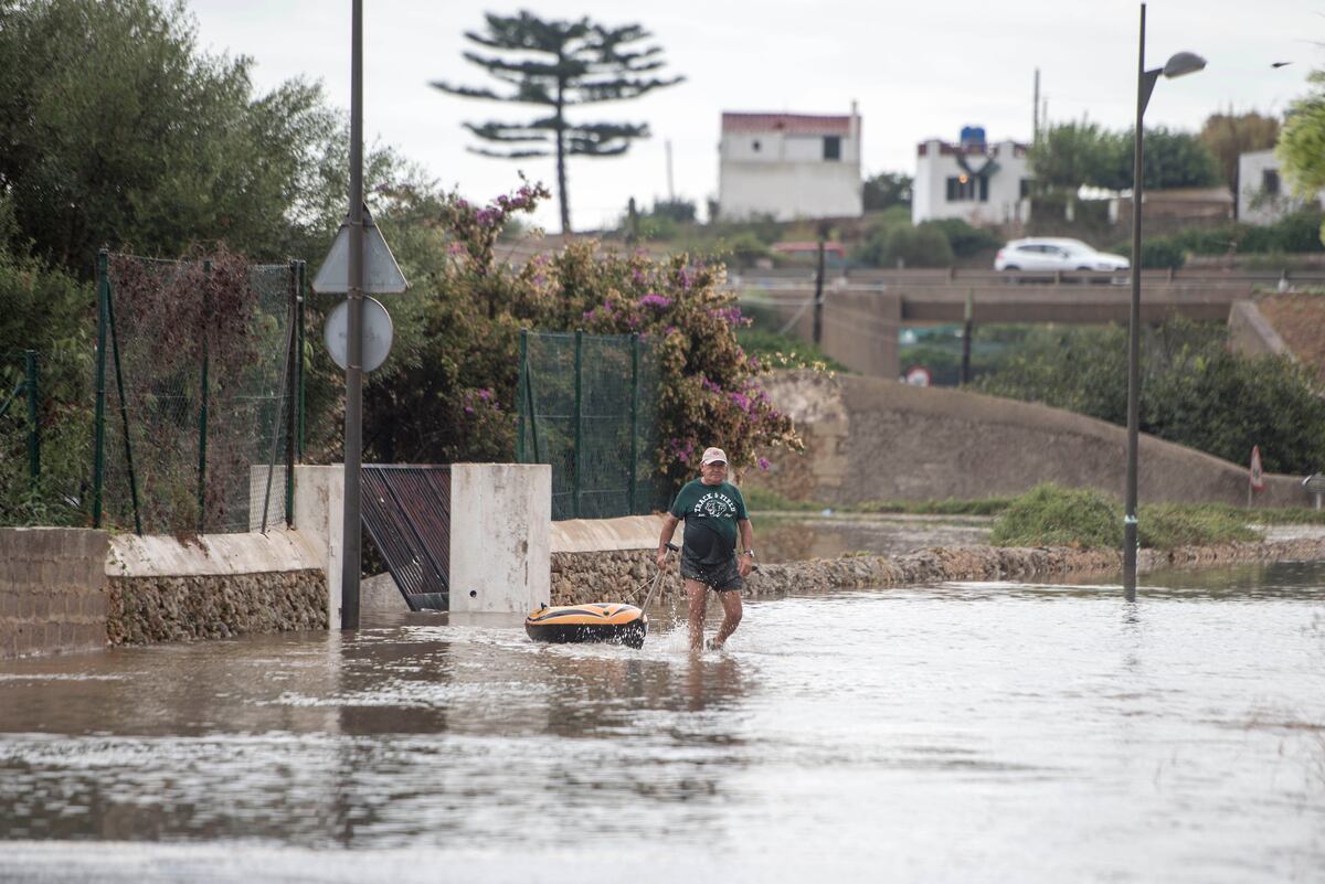
Aemet provided an initial report on the significant amount of rainfall that occurred in the Balearic Islands on Thursday due to the impact of the dana, which was intensified by the warm waters of the Mediterranean Sea. The island of Es Mercadal in Menorca received the highest amount of rainfall with a staggering 204.4 liters per square meter. This is a remarkable occurrence considering that the average monthly rainfall in the Balearic Islands is only around 20 liters. Other notable rainfall amounts were recorded in Ciutadella (96.8 liters), Menorca Airport (93.2 liters), Banyalbufar in Mallorca (80.4 liters), and Soller in Mallorca (75.8 liters).
Much of the rainfall in the Balearic Islands was torrential, meaning it fell with an intensity of over 60 liters per square meter in an hour. Es Mercadal once again led the list of stations reporting the highest hourly accumulations, with 78.4 liters. In Soller, 68.2 liters of rain fell in just one hour, while 19.4 liters were recorded in only 10 minutes. The localized nature of intense precipitation events in the region led to varying amounts of rainfall being reported by different official weather stations.
On Friday, the influence of the dana in the eastern Mediterranean region will gradually diminish throughout the day. However, lingering instability may lead to intense showers and storms in parts of the Balearic Islands, as well as the coast of Catalonia and the Cape of Nao in Alicante. In the afternoon, there is a possibility of convective cloud development in the eastern third of the Iberian Peninsula, with a chance of isolated showers and occasional thunderstorms in Catalonia and the Pyrenees of Huesca. Additionally, a weak front moving into northern Galicia will bring cloudy skies.
Temperatures are expected to rise overall, with a particularly noticeable increase in the northern half of the Iberian Peninsula and the mountainous regions of the Canary Islands. Interior regions of the southwest quadrant of the Peninsula could experience temperatures exceeding 36°C. Only a yellow weather warning for rainfall remains in place for Baleares, while Andalusia, Extremadura, and Galicia have yellow warnings for heat. By Saturday, the dana will have dissipated, and higher temperatures will return, especially in the southwest quadrant of the Peninsula and southern parts of the Canary Islands. On Sunday, the heat will spread to the southern third of the Peninsula and most of the Canary Islands.


