


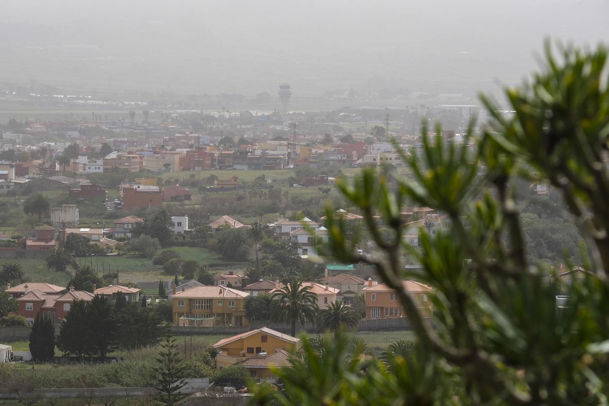
Spain entered fully into the announced warm second episode of April on Thursday, affecting most of the Iberian Peninsula and, especially, the Canary Islands, where the highest temperatures were recorded and the first heat warning of the year was activated. In the archipelago, temperatures will continue to be high over the weekend, although they will ease a bit, according to Rubén del Campo, spokesperson for the State Meteorological Agency (Aemet). However, in the Peninsula, temperatures “will continue to rise on Friday and Saturday, remaining unchanged on Sunday.” Monday will start to cool down in the northern half, where it will even be cold midweek, but in the southern half, temperatures will “continue to rise until Tuesday” and will remain elevated throughout the week.
On Thursday, temperatures exceeded 35°C in a dozen observatories in the Canary Islands, reaching 38.5°C in La Aldea de San Nicolás (Gran Canaria),” summarizes Del Campo. In the Peninsula, the hottest spot was in southern Galicia, with 32.2°C in Ourense, while in the Guadiana and Guadalquivir valleys, temperatures reached 30°C. The heat did not ease at night: in half a dozen stations in the archipelago, temperatures did not drop below 25°C, known as torrid nights. The highest minimum was recorded in Agüimes (Gran Canaria) with 27.5°C. These temperatures were very high for the time of year on Thursday, April 11th: no less than fifteen stations in #Canarias exceeded 35°C. In the Peninsula, Ourense reached 32°C. These records were up to 16°C above normal in the Canary Islands and 13°C in the Peninsula.
“This Friday, there was also a very warm dawn in some stations in Gran Canaria, with temperatures around 30°C at five in the morning,” notes the expert. And the worst part is that this “intense heat episode in the Canary Islands is part of a situation of above-average temperatures that has dominated everything so far in 2024,” notes Aemet. According to calculations by climatologist Dominic Royé, “out of the first 100 days, temperatures have only been below normal for three days, and there have been up to 57 days of extreme temperatures.” On Thursday, the first monthly records fell. In the Canary Islands, the Tenerife South airport station recorded 38.3°C, surpassing its previous high by two degrees, while Lanzarote airport recorded a minimum of 24.6°C, its warmest April night. In the Peninsula, Vigo exceeded 30°C for the first time in April. It is possible that more records will be broken in the northern Peninsula over the weekend, but not in the south, where the heat has been very intense in recent Aprils, with Cordoba reaching 38.8°C last year, the highest temperature for this month in the Peninsula and the Balearic Islands. In the Canary Islands, the April high is 40.2°C in Gran Canaria in 2013.
After a stifling Thursday, there will be a slight relief in the Canary Islands, but the rest of the country will face an even hotter weekend, especially in the northern half, where temperatures will be more typical of late June and will be between 10°C and 15°C above normal. Aemet warns that the risk of wildfires will be very high or even extreme in areas of Cantabria, the Mediterranean, and the Canary Islands, and that the ultraviolet radiation index will reach very high values, similar to those in August. “What affects us most is what happens closest to us. To not miss anything, subscribe.”
SubscribeBeginning on Monday, changes will begin: northerly winds will start blowing, bringing “colder air to the northern half,” where the temperature drop will be significant, with 8 to 10 degrees less in much of Galicia, Cantabria, the Pyrenees, and the upper Ebro. “Maximum temperatures will be below 18°C in much of the northernmost part of the Peninsula, where light rain may fall,” the expert predicts, also expecting isolated showers in the afternoon in parts of the interior, especially in the mountains of the northern half. However, “in the southern half, the thermal rise will continue,” with 30°C or more in the Ebro depression, the interior southeast, and points in Andalusia. In the Canary Islands, there will be no major changes, with a warmer and hazy atmosphere. From Tuesday and at least until Thursday, temperatures will gradually decrease in the Canary Islands and become normal, with no rain expected. In the Peninsula, “the flow of north winds will continue, leaving a cool to even cold atmosphere in the northern third, with possible rain in northern Galicia, Cantabria, and the Pyrenees.” Snow is expected in mountain areas in this area, especially in the Pyrenees, with a snow level of 1,000 to 1,400 meters.


