


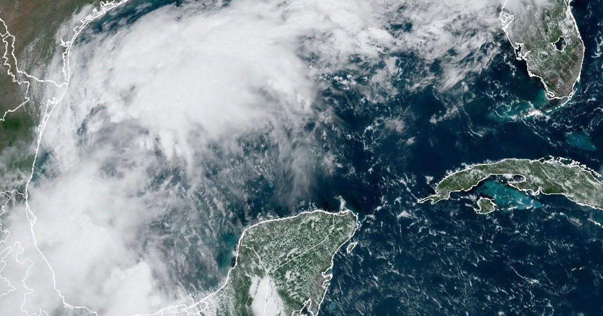
A disturbance in the Gulf of Mexico is expected to strengthen into a tropical storm and potentially evolve into a hurricane before reaching the U.S. Gulf Coast by midweek. Known as Potential Tropical Cyclone Six, the storm is currently positioned around 300 miles south-southeast of the Rio Grande and is moving in a north-northwest direction. According to the National Hurricane Center, Potential Tropical Cyclone Six is predicted to shift offshore of the northern Gulf of Mexico by Tuesday and approach the Louisiana and upper Texas coastline by Wednesday. Tropical storm watches are currently in effect for northeastern Mexico and southern Texas in anticipation of the storm’s impact.
The storm is anticipated to bring heavy rainfall and potential flash flooding along the coast of northeast Mexico, southern Texas, southern Louisiana, and southern Mississippi through Thursday morning, as per the hurricane center. While the exact location of impacts remains uncertain at this stage, the storm’s potential for life-threatening storm surge and damaging winds is increasing for portions of the Louisiana and Upper Texas coastlines starting Tuesday night. The 2024 Atlantic storm season has already experienced five named storms, three of which escalated into hurricanes. August’s tropical cyclone activity was slightly below normal in terms of the number of named storms, with hurricanes Debby and Ernesto making landfall in Florida and Bermuda, respectively.
The National Oceanic and Atmospheric Administration had initially predicted above-normal hurricane activity in the Atlantic basin this year, estimating a range of 17 to 25 total named storms, with eight to 13 potentially intensifying into hurricanes. This heightened activity was attributed to factors such as near-record warm ocean temperatures in the Atlantic, La Niña conditions in the Pacific, reduced Atlantic trade winds, and lower levels of wind shear. The overall outlook for the 2024 Atlantic storm season suggested increased likelihood of tropical storms and hurricanes forming due to these conducive environmental conditions.
As Potential Tropical Cyclone Six continues to develop in the Gulf of Mexico, it is essential for residents in the potentially affected regions to stay informed and heed any evacuation orders or safety precautions issued by local authorities. The storm’s movement and intensity are being closely monitored by meteorologists and emergency response teams to provide timely updates and guidance to communities in its path. With the potential for hazardous weather conditions, including heavy rainfall, strong winds, and storm surge, it is crucial for individuals to take necessary steps to protect themselves and their property from the potential impacts of the approaching storm.
Preparedness efforts, such as securing loose objects, stocking up on emergency supplies, and having a communication plan in place, can help minimize risks and ensure readiness in the event of severe weather. By staying informed through official sources like the National Hurricane Center and local meteorological agencies, residents can make informed decisions to safeguard their well-being and stay safe during the passage of Potential Tropical Cyclone Six. With the storm expected to intensify and potentially reach hurricane strength, proactive measures and vigilance are vital to mitigating the potential impacts of this developing weather system as it approaches the Gulf Coast in the coming days.


