


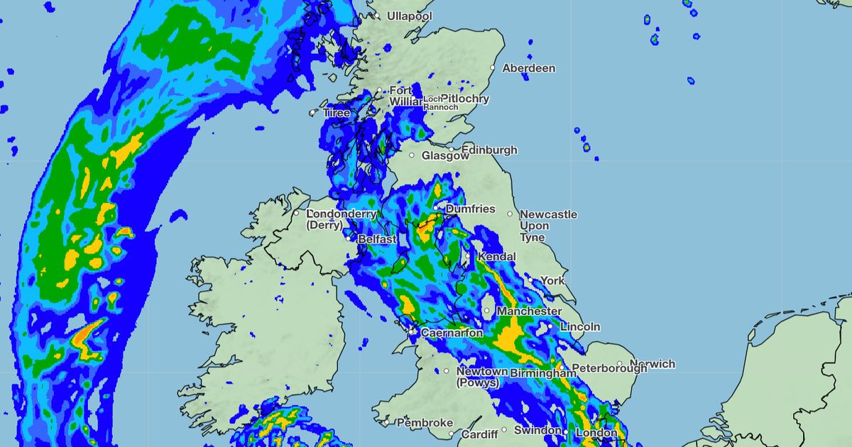
This week, Brits are facing heavy rain, with up to 6mm falling every hour in some places. Weather warnings for thunderstorms have been issued by the Met Office for most of Northern Ireland, south Wales, Devon, and Cornwall. A 750-mile wall of water is expected to hit the UK, stretching from Kent to Scotland. The rain is set to start on Monday and continue into Tuesday morning, potentially causing flooding in many areas. The Met Office forecast predicts a mix of sunshine and showers across the UK, with the heaviest showers and thunderstorms likely in southern parts.
The coming days are expected to be changeable with showers and thunderstorms developing across the UK. Temperatures will be around or slightly above average, with warm weather in sunnier areas. By the weekend, showers may ease in the north, leading to drier and settled conditions for a while. However, long-term weather patterns remain uncertain with signals unclear on how long higher pressure will last. Following a settled period, more unsettled conditions are likely to return, especially in the west, with above-average temperatures more likely than below-average ones. This forecast comes after temperatures reached over 24C across the UK over the weekend.
In addition to the heavy rain, Brits are also bracing for the heat with temperatures exceeding 24C over the past few days, with highs of 25.9C in East Sussex and 24.6C in central London. Portable air conditioners are set to be must-have gadgets in 2024 to help beat the heat at home over the weekend. The Met Office has issued warnings of persistent rain across Northern Ireland, Wales, and southwest England while most northern and eastern areas will see warm sunshine. The mix of showers and sunshine is expected to continue throughout the week, with the wettest conditions likely in the west. The rain is expected to ease by the weekend as drier, settled conditions become established for a while.
As the UK prepares for stormy weather and potential flooding, the Met Office is closely monitoring the situation. The 750-mile wall of water heading towards the country presents a significant challenge, with forecasts showing the rain reaching many major cities across the UK. The Met Office’s weather map for Tuesday morning highlights the extent of the rainfall, stretching from Dover in Kent to Tobermory in Scotland. Brits are advised to stay updated on the latest weather warnings and to take necessary precautions to stay safe during the heavy rainfall and thunderstorms. The unsettled conditions are expected to continue into the coming week, with above-average temperatures and the potential for more rain in western regions.


