


Conflicting federal policies are causing issues for residents in flood-prone areas, forcing them to pay more for flood insurance or be unaware of the dangers posed by dams upstream from their homes and workplaces. The problem arises from a complex set of flood policies and national security precautions implemented after the September 11, 2001, terror attacks. To receive discounts on flood insurance, communities must identify at-risk properties in the event of a dam failure, but some federal agencies restrict the release of this information for dams they own or regulate, citing security risks.
Despite warnings from officials, the problem has persisted for years. A California emergency services official highlighted the impact of federal dam information sharing procedures on communities, homeowners, and potentially citizens’ lives during a presentation to FEMA’s National Dam Safety Review Board. While the U.S. Army Corps of Engineers has begun publicly sharing maps of flood-prone areas in case of dam failures, other federal agencies like the Federal Energy Regulatory Commission and the U.S. Bureau of Reclamation continue to restrict this information. The Bureau of Reclamation plans to start sharing more information about dam-failure inundation zones in 2025, but the process could take over eight years to complete for all its dams.
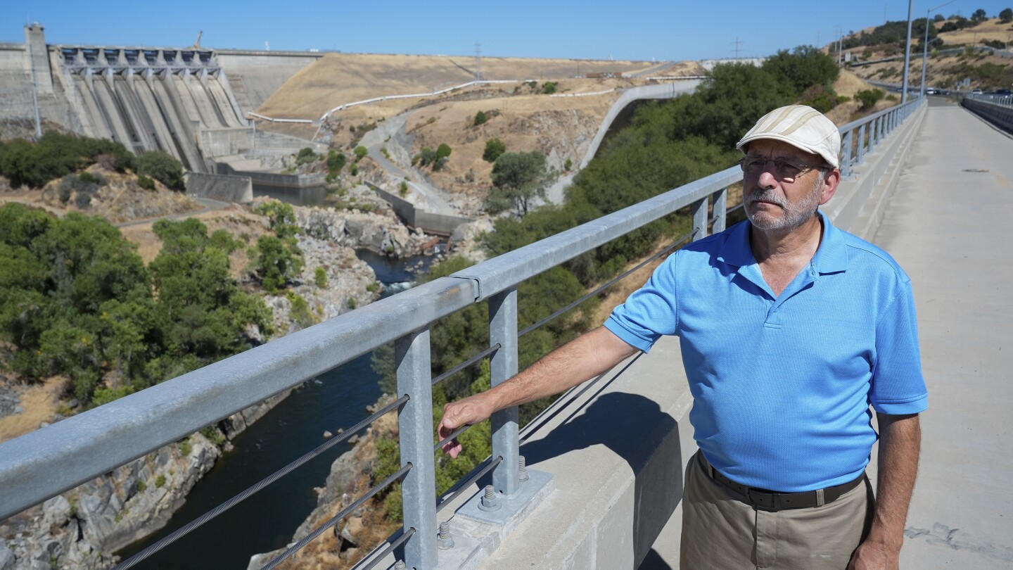
Communities like Sacramento, California, are struggling to qualify for flood insurance discounts due to restrictions on information about dams like the Folsom Dam. The lack of necessary information hinders their ability to meet FEMA’s criteria for mapping and public outreach about potential dam failures. Rising flood risks due to climate change and aging dams have led to costly damages in various states across the U.S. The National Flood Insurance Program does not cover flood damage under standard property insurance, and premium discounts based on FEMA’s Community Rating System can range from 5% to 45%.
Amid concerns about the effectiveness and complexity of FEMA’s Community Rating System, the agency has been seeking public input on potential revisions. However, these changes are not expected until 2026, with the U.S. Government Accountability Office suggesting a substantial overhaul may be necessary. Some local officials find the rating system costly and challenging, especially for communities with limited resources. While some communities have managed to earn points in the system, the process of obtaining information about potential dam failures remains difficult for many, leading to missed opportunities for flood insurance discounts.
Security concerns following the 9/11 attacks have led federal agencies like the Federal Energy Regulatory Commission and the Bureau of Reclamation to restrict the release of dam information, citing national security risks. While some agencies require non-disclosure agreements when sharing dam inundation maps and emergency action plans, others have started making this information publicly available. FEMA emphasizes the importance of communities having access to dam-failure inundation maps to warn residents at risk, as dam failures can have widespread impacts beyond high-risk areas. The complexities of the system and the reluctance of some federal agencies to share information about dam failures continue to pose challenges for communities trying to mitigate flood risks and ensure public safety.


