


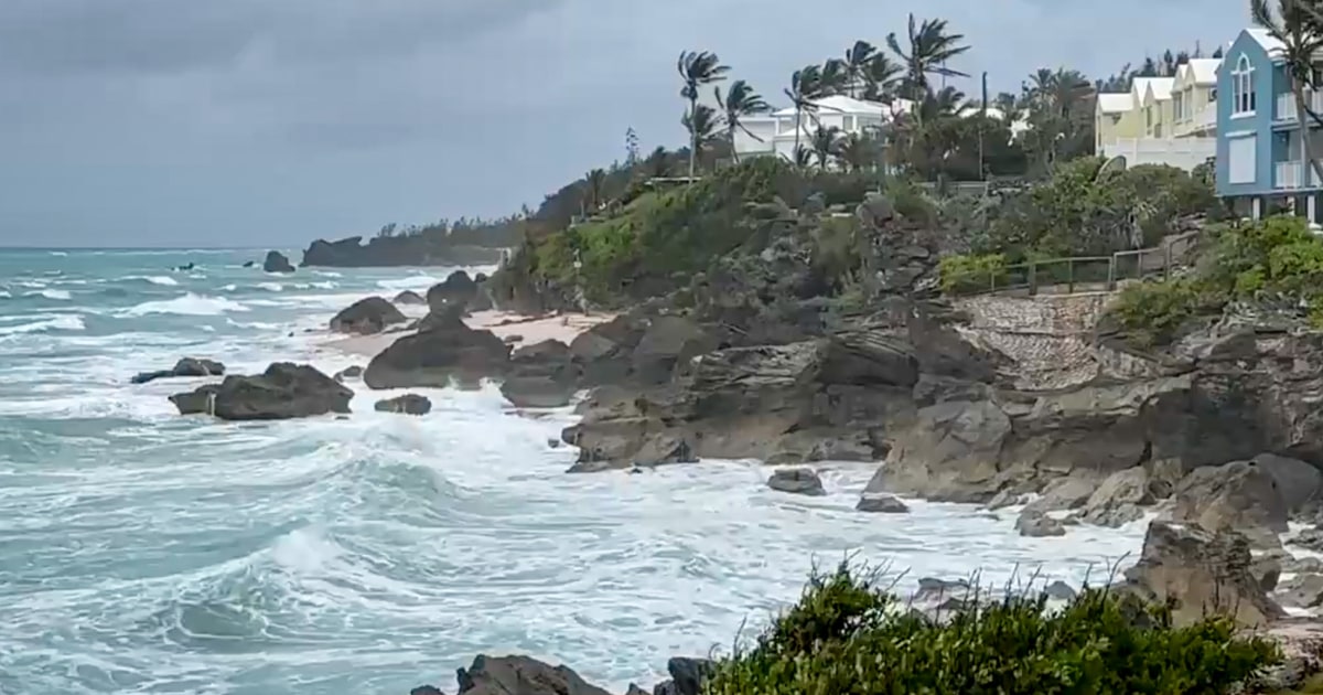
Ernesto made landfall in Bermuda as a hurricane, bringing hazardous weather to the Atlantic island. The storm initially landed as a Category 1 hurricane, but later weakened to a tropical storm as it continued its path. By early Sunday, it was located about 140 miles northeast of Bermuda. While the storm’s maximum sustained winds had decreased to 70 mph, forecasters warned that Ernesto could regain hurricane strength as it moved over open ocean waters. Ernesto was expected to become post-tropical near southeastern Newfoundland by Monday night or Tuesday morning. A tropical storm warning was still in effect in Bermuda, with heavy rainfall potentially leading to flash flooding and coastal flooding.
The slow-moving hurricane was expected to continue on its path before accelerating east-northeast later in the day. The government of Bermuda warned residents to remain cautious, as the eye of the storm could still impact the island despite moving north. Over 26,000 utility customers in Bermuda were without power, representing about 72% of the island. Although there have not been reports of major damage, emergency services were limited due to strong winds. Video footage captured in Hamilton, the island’s capital, showed debris but no damage to buildings. In Southampton, downed trees, power lines, and branches were observed. Dangerous beach conditions, including large waves and rip currents, were anticipated along the East Coast until early next week. New York City beaches in Queens and Brooklyn were closed to swimming, and beachgoers were evacuated from the water.
The National Hurricane Center warned that hurricane-force gusts remained possible on Bermuda, along with continued tropical storm conditions. The hurricane was expected to slowly move away from the island, passing near southeastern Newfoundland by late Monday and Monday night. Forecasters predicted that the southern eye wall of Ernesto could still impact Bermuda, urging residents to remain prepared for potential strong winds throughout the day. Weather experts advised that strong tropical storm-force winds would likely persist until the evening. Despite the approaching storm, there had not been any major reports of damage in Bermuda. Authorities kept residents updated on the storm’s progression and potential impacts.
Buoys measured significant waves off the East Coast, with heights of 7 feet off Cape Hatteras and 6 feet off Montauk Point. New York City officials closed beaches in Queens and Brooklyn to swimming due to concerns about rip currents. Beachgoers were directed to remain on dry sand for their safety. Emergency responders were on high alert in anticipation of possible flooding and other storm-related hazards. As heavy rainfall continued to pose a risk of flash flooding in low-lying areas, residents were advised to remain cautious and heed safety warnings. Ernesto’s slow motion and potential intensification were closely monitored by federal forecasters, who continued to provide updates and guidance to residents in affected areas.


