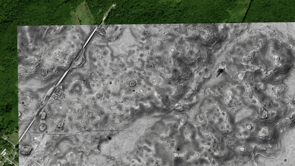
A recent discovery in southern Mexico has revealed a massive Maya landscape hidden under a forested area. The city, named Valeriana, is approximately the size of Beijing and exhibits characteristics of a Classic Maya political capital, with plazas connected by a large passageway, temple pyramids, and water reservoirs that would have impressed Mayans over 1,500 years ago. Archaeologists made this groundbreaking find while analyzing lidar data used by Nature Conservancy Mexico to study carbon intake and emissions in the region, leading to the identification of a place with high archaeological potential.
While the Maya Lowlands in southern Mexico have long been known to contain ancient urban settings, Valeriana provides new insights into the densely settled nature of the region. With more than 400 structures per square kilometer at its peak, Valeriana had a remarkable building density, over seven times that of the surrounding area. The city was likely home to many residents living in houses clustered around residential patios or engaging in rituals at pyramidal temples or the ball court. This discovery sheds light on the pattern of settlement within the Maya civilization and the agricultural activities that sustained these densely populated regions.
The use of lidar technology, which involves mapping the landscape using laser beams from aircraft, has been instrumental in uncovering archaeological sites in various regions around the world. By reprocessing lidar data collected by TNC Mexico for environmental analysis, researchers were able to create a topographic map of Valeriana, revealing its architectural layout and potential for further exploration. The data showed that Valeriana was located within the larger Maya Lowlands and could have been one of the most densely populated zones of the ancient Maya civilization.
The discovery of Valeriana highlights the importance of using innovative technologies like lidar to reveal hidden archaeological sites and gain a better understanding of ancient civilizations. By utilizing environmental data for archaeological purposes, researchers were able to confirm suspicions about the dense settlement patterns in the Maya Lowlands beyond the well-known city of Calakmul. This study underscores the value of lidar data in advancing archaeological research and provides valuable information about the Maya landscape and settlement patterns during the Classic Maya period.
Overall, the finding of Valeriana adds to the growing body of knowledge about the ancient Maya civilization and how they settled and interacted with their environment. The study showcases the potential of lidar technology to revolutionize archaeological research and uncover previously unknown sites of historical significance. By combining environmental data with traditional archaeological methods, researchers can paint a more comprehensive picture of ancient civilizations like the Maya and their impact on the landscape. Excavations at Valeriana and other similar sites could provide further insights into the daily lives and cultural practices of the Maya people, contributing to a deeper understanding of their rich history and legacy.


